


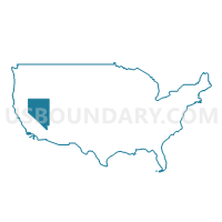
Clark County (East)--Mesquite City, Sunrise Manor (North), Moapa Valley & Nellis AFB PUMA, Nevada
About
Outline
--Mesquite+City%2c+Sunrise+Manor+(North)%2c+Moapa+Valley+%26+Nellis+AFB+PUMA%2c+Nevada_A280.png)
Summary
| Unique Area Identifier | 193357 |
| Name | Clark County (East)--Mesquite City, Sunrise Manor (North), Moapa Valley & Nellis AFB PUMA |
| State | Nevada |
| Area (square miles) | 2,017.35 |
| Land Area (square miles) | 1,873.53 |
| Water Area (square miles) | 143.83 |
| % of Land Area | 92.87 |
| % of Water Area | 7.13 |
| Latitude of the Internal Point | 36.37675920 |
| Longtitude of the Internal Point | -114.45252260 |
Maps
--Mesquite+City%2c+Sunrise+Manor+(North)%2c+Moapa+Valley+%26+Nellis+AFB+PUMA in Nevada.png)
Graphs
Select a template below for downloading or customizing gragh for Clark County (East)--Mesquite City, Sunrise Manor (North), Moapa Valley & Nellis AFB PUMA, Nevada
--Mesquite+City%2c+Sunrise+Manor+(North)%2c+Moapa+Valley+%26+Nellis+AFB+PUMA%2c+Nevada_T0.png)
--Mesquite+City%2c+Sunrise+Manor+(North)%2c+Moapa+Valley+%26+Nellis+AFB+PUMA%2c+Nevada_T1.png)
--Mesquite+City%2c+Sunrise+Manor+(North)%2c+Moapa+Valley+%26+Nellis+AFB+PUMA%2c+Nevada_T2.png)
--Mesquite+City%2c+Sunrise+Manor+(North)%2c+Moapa+Valley+%26+Nellis+AFB+PUMA%2c+Nevada_T3.png)
--Mesquite+City%2c+Sunrise+Manor+(North)%2c+Moapa+Valley+%26+Nellis+AFB+PUMA%2c+Nevada_T4.png)
--Mesquite+City%2c+Sunrise+Manor+(North)%2c+Moapa+Valley+%26+Nellis+AFB+PUMA%2c+Nevada_T5.png)
--Mesquite+City%2c+Sunrise+Manor+(North)%2c+Moapa+Valley+%26+Nellis+AFB+PUMA%2c+Nevada_T6.png)
--Mesquite+City%2c+Sunrise+Manor+(North)%2c+Moapa+Valley+%26+Nellis+AFB+PUMA%2c+Nevada_T7.png)
--Mesquite+City%2c+Sunrise+Manor+(North)%2c+Moapa+Valley+%26+Nellis+AFB+PUMA%2c+Nevada.png)
Neighbors
Neighoring Public Use Microdata Area (by Name) Neighboring Public Use Microdata Area on the Map
- Clark County (Central)--Greater North Las Vegas City PUMA, NV
- Clark County (Central)--Whitney, Sunrise Manor (South) & Paradise (Northeast) PUMA, NV
- Clark County (North)--Las Vegas (Northeast) & North Las Vegas (Outer) Cities PUMA, NV
- Clark County (South)--Henderson (East) & Boulder Cities PUMA, NV
- Las Vegas City (Southeast) PUMA, NV
- Mohave & La Paz Counties--Lake Havasu City PUMA, AZ
- Rural Nevada PUMA, NV
Top 10 Neighboring County (by Population) Neighboring County on the Map
Top 10 Neighboring County Subdivision (by Population) Neighboring County Subdivision on the Map
- Las Vegas CCD, Clark County, NV (1,771,945)
- Clark CCD, Clark County, NV (179,324)
- Kingman CCD, Mohave County, AZ (66,268)
- North Mohave CCD, Mohave County, AZ (10,851)
- Caliente CCD, Lincoln County, NV (1,263)
Top 10 Neighboring Place (by Population) Neighboring Place on the Map
- Las Vegas city, NV (583,756)
- Henderson city, NV (257,729)
- North Las Vegas city, NV (216,961)
- Sunrise Manor CDP, NV (189,372)
- Whitney CDP, NV (38,585)
- Mesquite city, NV (15,276)
- Boulder City city, NV (15,023)
- Moapa Valley CDP, NV (6,924)
- Nellis AFB CDP, NV (3,187)
- Scenic CDP, AZ (1,643)
Top 10 Neighboring Unified School District (by Population) Neighboring Unified School District on the Map
- Clark County School District, NV (1,951,269)
- Kingman Unified School District, AZ (65,381)
- Lincoln County School District, NV (5,345)
- Littlefield Unified District, AZ (3,930)
Top 10 Neighboring State Legislative District Lower Chamber (by Population) Neighboring State Legislative District Lower Chamber on the Map
- State House District 3, AZ (216,687)
- Assembly District 17, NV (96,848)
- Assembly District 18, NV (72,331)
- Assembly District 7, NV (67,025)
- Assembly District 14, NV (59,802)
- Assembly District 36, NV (59,012)
- Assembly District 20, NV (58,569)
- Assembly District 12, NV (54,356)
- Assembly District 19, NV (51,620)
- Assembly District 28, NV (44,394)
Top 10 Neighboring State Legislative District Upper Chamber (by Population) Neighboring State Legislative District Upper Chamber on the Map
- Clark County Senatorial District 7, NV (224,273)
- State Senate District 3, AZ (216,687)
- Clark County Senatorial District 12, NV (214,362)
- Clark County Senatorial District 1, NV (153,621)
- Clark County Senatorial District 4, NV (123,866)
- Central Nevada Senatorial District, NV (113,138)
- Rural Nevada Senatorial District, NV (97,335)
- Clark County Senatorial District 2, NV (96,601)
- Clark County Senatorial District 10, NV (96,111)
Top 10 Neighboring 111th Congressional District (by Population) Neighboring 111th Congressional District on the Map
- Congressional District 3, NV (1,043,855)
- Congressional District 2, AZ (972,839)
- Congressional District 2, NV (836,562)
- Congressional District 1, NV (820,134)
Top 10 Neighboring Census Tract (by Population) Neighboring Census Tract on the Map
- Census Tract 9501, Mohave County, AZ (10,851)
- Census Tract 36.28, Clark County, NV (7,841)
- Census Tract 54.36, Clark County, NV (7,266)
- Census Tract 47.14, Clark County, NV (6,367)
- Census Tract 47.10, Clark County, NV (6,351)
- Census Tract 49.25, Clark County, NV (6,274)
- Census Tract 49.21, Clark County, NV (6,160)
- Census Tract 47.15, Clark County, NV (6,027)
- Census Tract 49.12, Clark County, NV (6,023)
- Census Tract 47.12, Clark County, NV (5,911)
Top 10 Neighboring 5-Digit ZIP Code Tabulation Area (by Population) Neighboring 5-Digit ZIP Code Tabulation Area on the Map
- 89110, NV (70,994)
- 89115, NV (58,794)
- 89030, NV (53,928)
- 89101, NV (46,055)
- 89122, NV (45,720)
- 89104, NV (39,909)
- 89015, NV (38,993)
- 89142, NV (33,731)
- 89081, NV (29,774)
- 89156, NV (27,794)